Sign In | Join Free | My xxjcy.com |
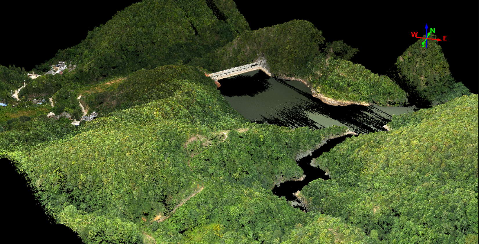
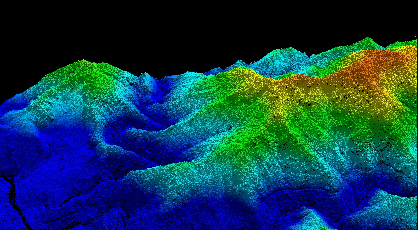
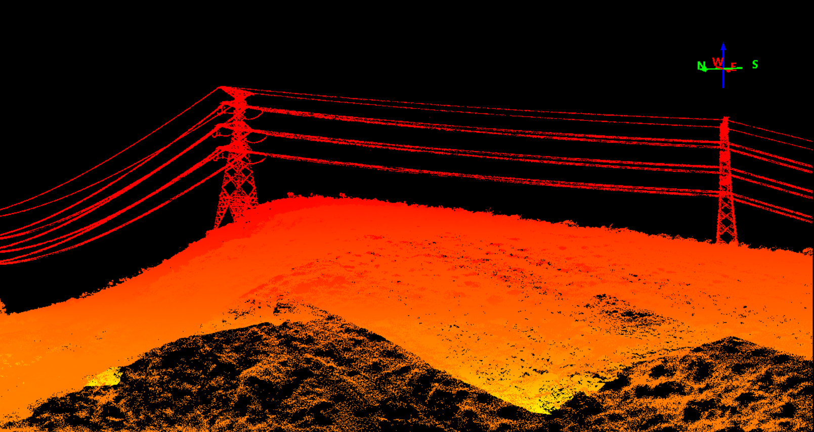
|
Brand Name : Geosun
Model Number : GS-1500N LiDAR Scanning System
Certification : CE, ISO
Place of Origin : China
MOQ : 1
Price : Negotiation
Payment Terms : T/T, Western Union
Supply Ability : 30 SETS/Month
Delivery Time : 10 works days
Packaging Details : Suit Case 450*365*200 mm
Name : LiDAR Scanning System
Operation Efficency : 2.8 k㎡ per single flight
Application : Topography, Forestry, Powerline, Smart City
Channel : Mapping & Survey
Material : Aluminum alloy Body
Accuracy : 10cm@400m
Dimension : 238*102*130mm
Weight : 2.5kg
Storage : 128GB TF Card, Support maximum 256 GB
Working Temperature : -20°~+55°
Carry Platform : Multi Rotor/VTOL
Trajectory Software : Shuttle
Point Cloud Software : gAirHawk
Measuring Range : 1000m @ 80% Reflectivity
Returns : Up to 8(Customized)
Point Rate : Up to 1,500,000 pts/sec
Laser Safety : Class 1
IP Rating : IP64
Geosun GAirHawk Series GS-1500N LiDAR Scanning System 8 Echos Long Detection Aerial VTOL Mapping High Accuracy
Geosun gAirHawk Series GS-1500N LiDAR Scanning System
gAirHawk GS-1500N is a kind of long range, compact LiDAR point cloud data acquisition system, integrated FT-800 long range laser scanner, GNSS and IMU positioning and attitude determination system, and storage control unit, is able to real-time, dynamically, massively collect high-precision point cloud data and rich image information. It is widely used in the acquisition of 3D spatial information in surveying, electricity, forestry, agriculture, land planning. GS-1500N LiDAR Scanning System.pdf
Specification of LiDAR Scanning System gAirHawk GS-1500N
LiDAR scanning system gAirHawk GS-1500N | ||
| Item Name | System Parameters |
Parameters | Accuracy | 10cm@400m |
Weight | 2.5kg | |
Working temperature | -20℃~+55℃ | |
Power range | 12 V- 24 V | |
Consumption | 65 W | |
Carrying Platform | 6 Aixs Multi Rotor Drone,VTOL | |
Storage | 128GB TF Card, Support Maximum 256 GB | |
IP Rating | IP64 | |
Dimension | 238*102*130mm | |
Laser Unit
| Measuring Range | 1000m@80%Reflectivity |
Laser class | 1535 nm Class1 (IEC 60825-1:2014) | |
Laser line number | FT-800 Single-Beam | |
Range Accuracy | 5mm@100m | |
Laser Wavelength | 1535m | |
Returns | 8 echos(Customized) | |
Scanning frequency | 100HZ-2000HZ | |
Point Rate | Up to 1,500,000 pts/sec | |
Laser Type | Single Line Mechanical Scanning | |
FOV | 100°, adjustable | |
POS Unit | Update frequency | 200HZ |
Heading accuracy | 0.010° | |
Pitch accuracy | 0.003° | |
Rolling accuracy | 0.003° | |
Position accuracy | Horizontal: 0.01m, Vertical: 0.02m | |
GNSS signal type | GPSL1/L2/L5 GLONASSL1/L2 BDS B1/B2/B3 GAL E1/E5a/5b | |
IMU | gSpin 410 | |
Pre-processing software | POS software | Output information: position, speed, attitude |
Point cloud software | Output point cloud data format: LAS format, custom TXT format | |
Camera (built-in) | FOV | 48*33 Degree |
Effective Pixel | 45 MP (Full Frame Camera) | |
focal Length(mm) | 16 |
Applications of LiDAR Scanning System gAirHawk GS-1500N
Free Trial Software LiDAR Scanning System gAirHawk GS-1500N
Free trial test, achieve high precision
The Guideline of LiDAR Usage and Reference.pdf
Point Cloud Pre-Processing Software Integrated With Trajectory Processing----Geosun Self-developed gAirHawk 5.0
Key Features of gAirHawk 5.0 Software
1. Raw data: intelligently load
2. Four default coordinates
3. Point cloud Optimization
4. Start and stop calculation
Package of LiDAR Scanning System gAirHawk GS-1500N
LiDAR Scanning System gAirHawk GS-1500N is packed by suit case with EVA material liner inside, then covered by hard carton box.
The pacakge of uav LiDAR scanning system is suitable for air shipment and sea shipment.
IP64 |
![]() |
GAirHawk Series GS-1500N LiDAR Scanning System 8 Echos Long Detection Aerial VTOL Mapping Images |